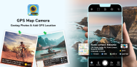
GPS Map Camera helps users who need photos to show where and when work, visits, or events happened. It suits site inspections, property records, delivery evidence, field surveys, construction updates, and travel notes. Instead of keeping location details separately, the app places capture information directly with the photo. This makes geotagged photos easier to review later when sharing records with a client, team, or project contact.
Location and time stamps
GPS Map Camera can add latitude and longitude, an address, date, time, timezone, and location accuracy when you capture a photo. You can select a full address or a shorter version depending on how much detail the image needs. The app sources these details at capture, so the recorded location and time cannot be manually changed afterward.
Map context on each image
You can include a map with your photo to show the surrounding location. GPS Map Camera offers Normal, Satellite, Terrain, and Hybrid map views, while the map scale can be adjusted for the level of context you need. This can help when a written address alone does not clearly identify a site or inspection point.
Flexible stamp templates
GPS Map Camera provides Classic templates for a basic GPS photo stamp and Advanced templates for records that need more context. Advanced options can include Plus Codes, notes, hashtags, logos, weather details, compass direction, altitude, wind, humidity, pressure, and magnetic field data. For example, a property image may need only an address and date, while a field report may need a fuller record.
Stamp layout controls
You can change the font, color, size, position, and fields shown in a stamp. GPS Map Camera also supports decimal coordinates and DMS coordinates, so users can match the format used by a project or team. Keeping only essential fields visible can leave photos clearer, while detailed layouts can support audits and progress reports.
Camera and record tools
GPS Map Camera includes grid lines, aspect ratio settings, flash, focus, timer, scene modes, filters, and front camera support. After capture, you can use automatic file names, choose save folders, and browse photos on a map. The app can also create image or PDF reports, including before and after comparisons, and supports QR code navigation for saved locations.
Before downloading a GPS Map Camera APK, consider whether your photos need to act as records rather than simple images. The app is designed for situations where a visible location and time stamp can support a delivery record, project update, environmental observation, or event log. Its report and folder options may be useful when many images need to be kept together by job, place, or date.
For site teams, before and after images can document a change at the same location. Real estate users can attach clear location context to listing or visit photos. Survey and field workers can choose detailed capture information when a record needs to be checked later, while users taking routine photos can use a smaller stamp to avoid covering too much of the image.
GPS Map Camera works by collecting available location details while you take a picture and placing selected information on the result. To create a location and time stamp, first decide how much information should appear on each photo. The following process helps keep stamps and saved records consistent.
Open GPS Map Camera and allow the phone to provide the location information needed for the photo stamp.
Choose a Classic or Advanced template, then select fields such as coordinates, address, date, time, map, or notes.
Adjust the stamp’s font, color, size, placement, and coordinate format so the details remain readable without hiding the subject.
Select camera options such as flash, timer, grid, aspect ratio, focus, or front camera, then capture the image at the location.
Review the saved photo in the selected folder or map view, then share an image or create a PDF report when the record is needed.
GPS Map Camera combines photo capture with visible location records, map context, and reporting options for personal or work use. Check the GPS Map Camera latest version for the available templates and tools before installing.
Official information is available from the developer:
Website: https://gpsmapcamera.com/
Email: contact@gpsmapcamera.com
Latest Version
1.9.37Uploaded by
Katharine Thomas
Requires Android
Android 10.0+
Category
Free Photography AppContent Rating
Everyone
Report
Flag as inappropriateLast updated on Sep 29, 2026
- Now fully compatible with Android 16



APKPure - A multi-platform app store primarily focused on Android, providing extensive app-related content. Discover the app you want easier, faster, and safer, with quick and efficient downloads and installations.